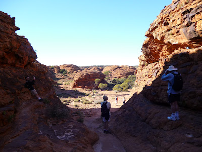
Kings Canyon, Northern Territories
The route will cover:
|
|
OK, who stole the roads! Actually we did our homework and there are quite a few options although most of the distances are on unsealed roads. It’s a case of check the weather before setting off. If all fails we can always go back to the Stuart Highway on sealed roads to get to Alice Springs but that’s the long way around and ………. there’s no sense of adventure in doing that!
|
Now this map should speak volumes! Like, where is the road? Actually we have had a close look at the area and there really is roads although for the better part they are unsealed. It’s a case of checking the weather conditions before travelling.
The caravan park
Kings Canyon tourist park is located midway between Alice Springs and Uluru (Ayers Rock), Watarrka National Park covers 71,000 hectares and is home to Kings Canyon. Kings Canyon Resort is situated just 7km from the Canyon
Caravan Park & Campground Facilities
- Desert Oaks Bistro
- Outback BBQ and Grill
- The Thirsty Dingo Bar
- Outback Oasis General Store (hot and cold food available)
- Souvenir shop
- Petrol station
- Laundry
- Internet café
- Public phones
- Outdoor BBQs
- Swimming pool
- Day and Night tennis court
- Sunset viewing platform
- Children's playground
Mobile and TV reception:
Mobile coverage - None available
TV reception includes:
1 Analogue channel available - poor reception
Rates:
The Campground consists of 72 Powered Camping Sites, which are spacious and offer plenty of room to relax. Most sites are located amongst trees in shaded areas and every site is provided with power - electrical outlets 240/250 Volt, 50Hz AC. Close to all facilities and with fantastic views!
The Holiday Park also features special Motorhome Sites with easy turning access for large vehicles.
Adult $21 / Children (6–12 years) $8 / Children (5 years and under) free
Family Rate (2 adults and up to 4 children) $48
Minimum charge $35
Family Rate (2 adults and up to 4 children) $48
Minimum charge $35
Surrounding area:
The major attraction is, of course, The Kings Canyon. As Kings Canyon lies just 3 hours from Uluru (Ayers Rock) and approximately 4 hours from Alice Springs, self-drive is a popular option. The drive passes some incredible sites, including Standley Chasm, Ellery Creek and Ormiston Gorge. The Mereenie / Larapinta Loop Road brings you right to the doorstep of the resort.
- Kings Canyon to Alice Springs via Stuart Highway - 461km (about 4.5-hour drive, travelling on a sealed road)
• Kings Canyon to Alice Springs via Mereenie / Larapinta Loop Road - 320km (about 3.5-hour drive, unsealed road for 198km)
• Kings Canyon to Alice Springs via Ernest Giles Road - 330km (about 3.5-hour drive, unsealed road for 70km)
• Kings Canyon to Uluru - 306km (about 3-hour drive)
• Uluru to Alice Springs - 465 km (a one-hour flight or 4.5-hour driving on sealed road)
- Kings Canyon to Coober Pedy - 753km (about 8-hour drive)
We left Yalara around 9:15am and drove a leisurely 80klm/hr to the Kings Canyon resort after a midway coffee break. We will be staying here for just two nights so that really gives us just one full day to scout the surrounds.
On arrival we quickly unhitched the caravan drank a bowl of soup with bread rolls and drove to the canyon for our first walk (The Kings Creek walk). Needless to say, we have some photographs:
Typical pathway during the Kings Creek walk
The view during the Kings Creek Walk.
One of the many information plaques encountered during the Kings Creek walk.
We took quite a few photographs, all of which are on my Facebook page.
The following day we decided to walk different walks. Liz took on (and conquered) the 6 Km 'Rim walk' whilst I drive to Kathleen Springs and walked an easier walk.
'The Rim Walk'
(Judged by some seasoned Australian walkers as one of the best treks in Australia).
(Judged by some seasoned Australian walkers as one of the best treks in Australia).
This is the first part of the climb to the rim. Look carefully and you'll see someone near the top of the track. After this point there is a 5.5 Klm. walk across some fairly rugged terrain.
Kings Canyon - 'The Rim'
The rim rock formations.
Kathleen Springs:
Scott's easy walk -
A description of the easier walk.
Part of a stock herding point.
There are plenty of information plaques which paint the history of the past.
One of the many places well worth a photograph.
Many more photographs of the above walks are on my Facebook page

.jpg)


No comments:
Post a Comment