Wednesday 31 July 2013

Alice Springs


Alice Springs, Northern Territories

The route will cover:


There are several options on how to get from Kings canyon to Alice Springs. It’s possible to travel between the two locations entirely by sealed road (the longest distance) or by two other routes comprising part sealed road and part unsealed. We need to check the weather conditions before attempting to pull the caravan over unsealed roads!

Alice Springs is commonly called “The Alice”


We chose to drive the long way round rather than the 4 wheel drive route as a couple advised us the roads were very bad. It took them 3.5 hours to drive 100 Klm’s and they damaged their van mirror and toilet.

Our drive meant a revisit to Erldura Road house for a petrol top up ($2.00/Ltr) then the remaining trip along the Lassiter Highway until joining the Stuart Highway into the Alice.

Only once did I pull up on the shoulder of the road to let a rather big road train pass!


The caravan park

Lot 8483, Ragonesi Rd   
Alice Springs, NT 0870 
Daily 8:00am- 6:00pm 
(after hours night bell and phone)
Tel: (08) 8952-3135
Tel: (08) 8953-1418
Fax: (08) 8953-1918

Mobile and TV reception:

Mobile coverage

Optus - 3 bars out of 5 - works well
Telstra broadband - Dongle provides 3 bars - not bad

TV reception includes:
19 Digital channels
6 Analogue channels
5 Radio channels

Rates: 
$36 per night for 2 adults
(Buddy is free!)

Surrounding area:

  • MacDonnell Ranges
  • Simpsons Gap
  • The Larapinta Trail
  • Standley Chasm

Wednesday 31st July

On our first full day we drove into the city centre and walked the ‘Heritage walk’ taking photographs in our travels


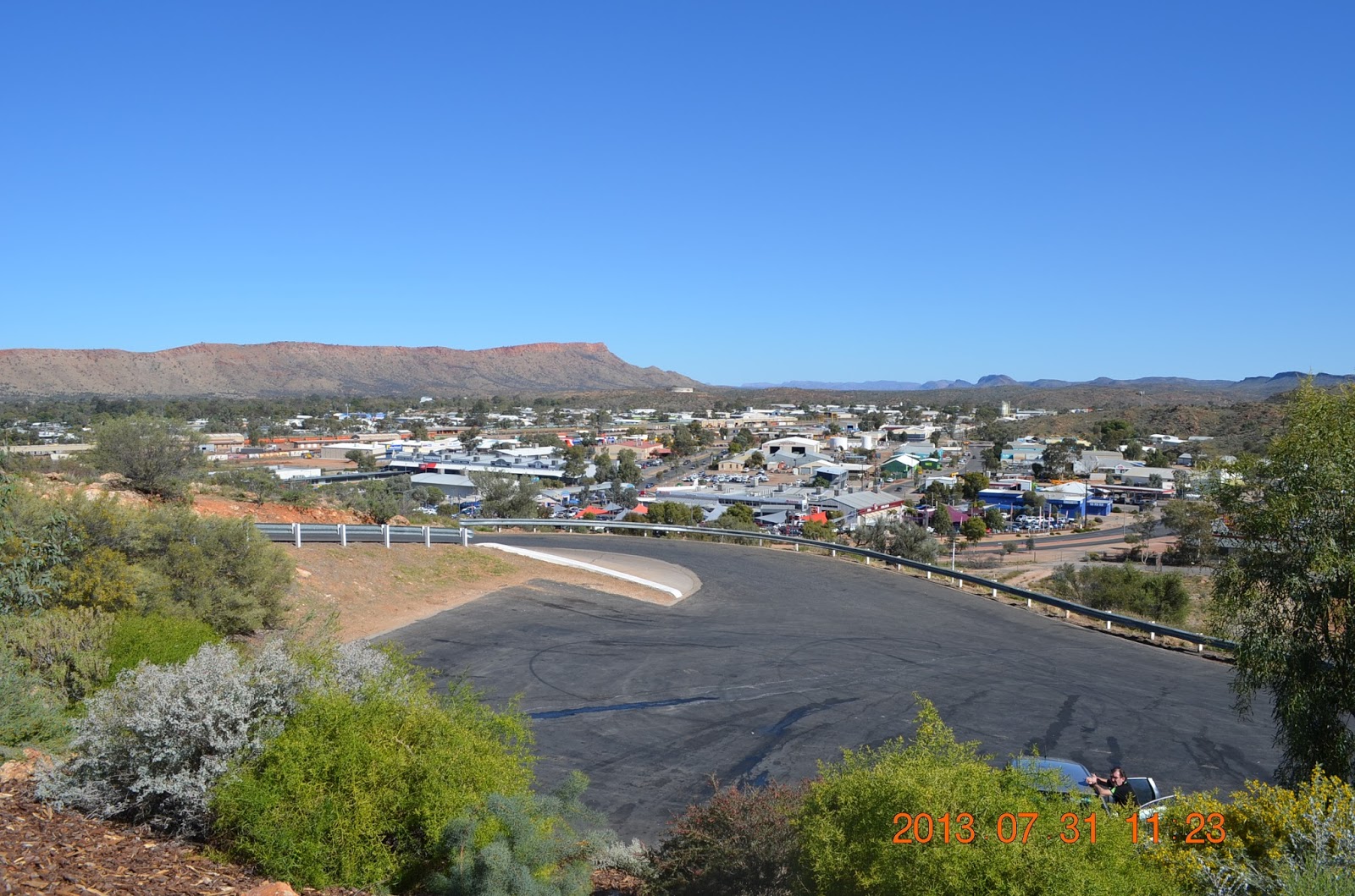
A view of Alice Springs from the Anzac Memorial hill.


The Anzac memorial


Alice Springs mall.


A little bit of Alice Springs history.


I never knew just how much Dr. John Flynn did for Australia - A truly great man.

Alice Springs hosts the first Royal Flying Doctor Service site created in Australia.


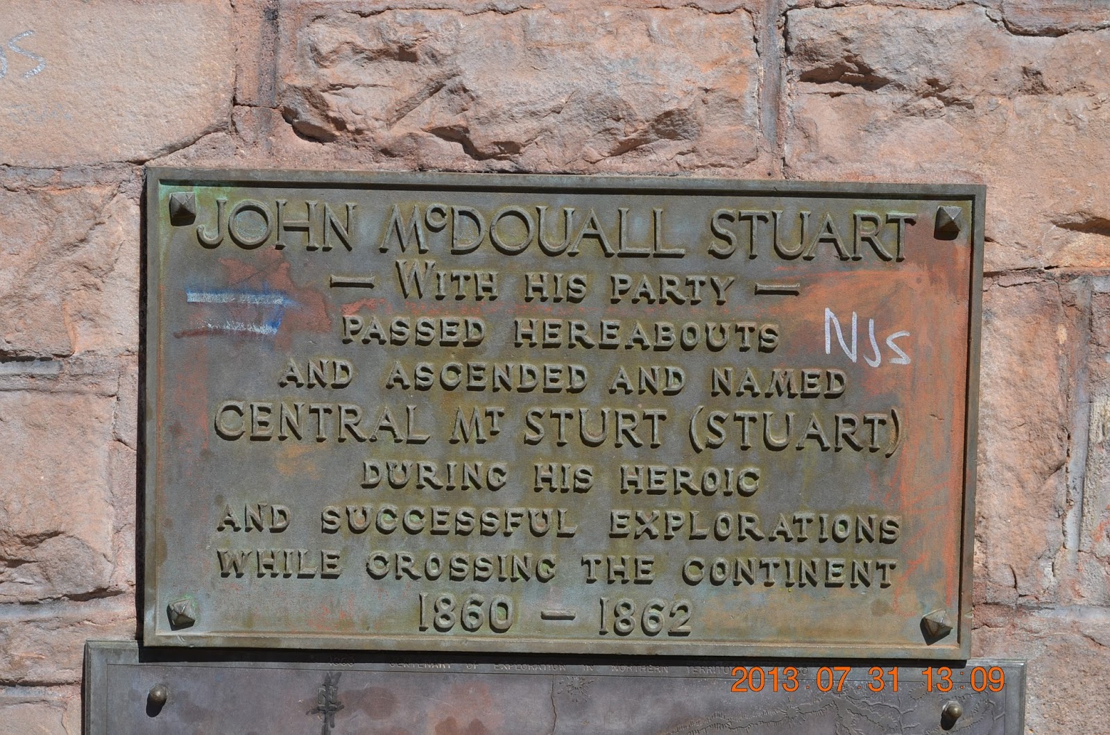
This is the location where the Stuart Highway carves its way through the MacDonnell Ranges.  Known as "Heavi Tree Gap".


Thursday August 1st:

We split today up between to locations. The first was the School of the Air and the second was the Desert Park. Both were well worth the visit.

School of the Air:


A look at some of the equipment in use in times gone bye.


This is a map of the students using the School, about 130 in total. "Class" size is generally about 8 - 13 in total, however, in some cases class student can be up to 4000 kilometres apart.


Desert Park:

Desert Park is like a nature walk. Rangers put on talks to describe the park and all that it contains. Basically, the purpose is to describe what happens in a desert.


One of many information plaques dotted around the complex.


Part of the park with the MacDonnell range in the background.


One of the many inhabitants of the park.


Our instructor describes the various uses of the trees and grasses of the desert used for medical purposes.


A ranger puts on a live bird show while describing their habits. (It took several shots to get a usable photograph!).


On our arrival back at the caravan park we hitched up the caravan in preparation for the next part of our journey - destination Tennant Creek


Tuesday 30 July 2013

Kings Canyon


Kings Canyon, Northern Territories

The route will cover:


OK, who stole the roads! Actually we did our homework and there are quite a few options although most of the distances are on unsealed roads. It’s a case of check the weather before setting off. If all fails we can always go back to the Stuart Highway on sealed roads to get to Alice Springs but that’s the long way around and ………. there’s no sense of adventure in doing that!


Now this map should speak volumes! Like, where is the road? Actually we have had a close look at the area and there really is roads although for the better part they are unsealed. It’s a case of checking the weather conditions before travelling. 


The caravan park

Kings Canyon tourist park is located midway between Alice Springs and Uluru (Ayers Rock), Watarrka National Park covers 71,000 hectares and is home to Kings Canyon. Kings Canyon Resort is situated just 7km from the Canyon

Caravan Park & Campground Facilities


Mobile and TV reception:

Mobile coverage - None available

TV reception includes:

1 Analogue channel available - poor reception

Rates: 

The Campground consists of 72 Powered Camping Sites, which are spacious and offer plenty of room to relax. Most sites are located amongst trees in shaded areas and every site is provided with power - electrical outlets 240/250 Volt, 50Hz AC. Close to all facilities and with fantastic views!
The Holiday Park also features special Motorhome Sites with easy turning access for large vehicles.
Adult $21 / Children (6–12 years) $8 / Children (5 years and under) free
Family Rate (2 adults and up to 4 children) $48
Minimum charge $35 
Surrounding area:

The major attraction is, of course, The Kings Canyon. As Kings Canyon lies just 3 hours from Uluru (Ayers Rock) and approximately 4 hours from Alice Springs, self-drive is a popular option. The drive passes some incredible sites, including Standley Chasm, Ellery Creek and Ormiston Gorge. The Mereenie / Larapinta Loop Road brings you right to the doorstep of the resort. 

  • Kings Canyon to Alice Springs via Stuart Highway - 461km (about 4.5-hour drive, travelling on a sealed road)
Kings Canyon to Alice Springs via Mereenie / Larapinta Loop Road - 320km (about 3.5-hour drive, unsealed road for 198km)
Kings Canyon to Alice Springs via Ernest Giles Road - 330km (about 3.5-hour drive, unsealed road for 70km)
Kings Canyon to Uluru - 306km (about 3-hour drive)
Uluru to Alice Springs - 465 km (a one-hour flight or 4.5-hour driving on sealed road)
  • Kings Canyon to Coober Pedy - 753km (about 8-hour drive)

We left Yalara around 9:15am and drove a leisurely 80klm/hr to the Kings Canyon resort after a midway coffee break. We will be staying here for just two nights so that really gives us just one full day to scout the surrounds.

On arrival we quickly unhitched the caravan drank a bowl of soup with bread rolls and drove to the canyon for our first walk (The Kings Creek walk). Needless to say, we have some photographs:


Typical pathway during the Kings Creek walk


The view during the Kings Creek Walk.


One of the many information plaques encountered during the Kings Creek walk.


We took quite a few photographs, all of which are on my Facebook page.

The following day we decided to walk different walks. Liz took on (and conquered) the 6 Km 'Rim walk' whilst I drive to Kathleen Springs and walked an easier walk.

'The Rim Walk'

(Judged by some seasoned Australian walkers as one of the best treks in Australia).


The notice board inviting the healthy to the Kings Canyon walk ('The Rim).


This is the first part of the climb to the rim. Look carefully and you'll see someone near the top of the track. After this point there is a 5.5 Klm. walk across some fairly rugged terrain.


Kings Canyon - 'The Rim'


The rim rock formations.


Kathleen Springs:

Scott's easy walk -


A description of the easier walk.


Part of a stock herding point.


There are plenty of information plaques which paint the history of the past.


One of the many places well worth a photograph.


Many more photographs of the above walks are on my Facebook page

Wednesday 24 July 2013

Uluru


Uluru, Northern Territories

The route will cover:


One can hardly get lost on the Lasseter Highway/Red Centre Way! We pass Curtin Springs Airport to our left and the Royal Flying Doctor Service and medical centre at Yulara before arriving at Uluru.

We pulled into the Curtin Springs roadhouse to top up the petrol - $2.24/Ltr!!!!!

The caravan park:


Ayers Rock Campground at Yulara
Phone: +61 8 8957 7001
Email:
campground@ayersrockresort.com.au
Mobile and TV reception:

Mobile coverage:

Optus 4 out of 5 bands for signal strength
Telstra 4 out of 5 bands for broadband

TV reception includes:

4 Analogue stations - Fairly good reception


Rates: 

Nightly Campground Rates*
Room Type
Rate
Extra Person
Child
Valid for travel 1 June 2013 - 31 August 2013
Campground Cabin^
$155 (1-6 people)


Camping Powered Site
$46 (1-2 people)
$19.50
$9.50


This was our first encounter of Ayres Rock. We had just passed through Curtin Springs and were about 80 Kilometres from Uluru. The rock had a purple tinge to its colour and seemed to dominate the view


Needless to say, Buddy wanted into the act, just to prove he was there!


Buddy gets into all the photographs!


Surrounding area:

Two major attractions. One is, of course, Ayres Rock, the other, The Olgas

Liz: The landscape changed all the way to-day & is very interesting, then there it was - our first sighting of the monolith. It was quite an emotional time for me as I did not think I would ever see Uluru & we just happened to have Pavarotti's beautiful voice to complete a surreal moment in time.

We arrived at the Uluru caravan park at 3pm and simply set up the caravan, had a look around the facilities of the site (It included a Police Station, Ambulance station, Fire Station, several shops, a supermarket. I’m sure there was more but that was what we saw.

At sunset (6:17pm) I set off to the local lookout (in the park) and took a few shots of Ayres Rock (Uluru)


This shot was taken from the lookout point with the caravan park at Uluru. Ayres Rock was about 30 kilometres from us, so I took the shot with my telephoto Lenz.

Tomorrow we will pick up a permit ($25/per adult for 3 days) and get really close.

Thursday 25th July.

True to our schedule we drove to Uluru to get up close and personal with Ayres Rock. Despite thinking it was just another rock (other than its immense size - well it is a monolith ) there was a certain ambience when close by. It was also amazing to see how much flora had taken hold. Anyway, without further ado, here are a few of the 69 photographs I took (it was difficult to stop as there was so much to see).


One of the many angles of Uluru


Trying (unsuccessfully) to give the impression of height!


Take a load off your feet


Surrounding foliage basking in the shadows of Uluru (Ayres Rock)


Grass and trees via for a spot in the sun


Signs from time gone by.


It's not 'just a rock'


The site had many information plaques describing what was to be seen

Our final visit to Uluru was at sunset. Here are a few photographs of the rock, taken within 10 minutes:


The remainder of the photographs are on my Facebook page.

Tomorrow we visit Kata Tjuta (the 'Olgas') where we intend doing a few little walking tours.

Friday:

Today we drove 50 kilometres to Kata Tjuta to walk the 'Valley of the winds', and to take photographs during the walk and during the sunset.

The walk included sections graded 1 (easy), 2, 3 and 4 (difficult). I managed the first three but gave up during the grade 4 section - it was a heart stopper!

Here is a few of the photographs; again the rest are on Facebook:


This was our first sight of the Olgas. I guess we were about 10 kilometres away around 2pm in the afternoon.

The drive from Yulara (where our caravan was located) to the Olgas was about 50 kilometres each way.


I read, somewhere, that the highest peak in the Olga's was about 235 feet higher than Uluru. It was certainly an imposing sight.


Fortunately there were a lot of information plaques around that provided important historical facts regarding the area and the people who lived (and still do) look after the national park.


This and the following photos show the colour change at sunset.


Oh well, just had to get into the act :)


The sun has almost set.


The final shot at sunset.


Saturday:

For our last day, we decided to revisit Uluru and do a walk we had not done before. It was graded 'Easy" - and so it was.


Our base station for the 'Kuniya Walk' showing the South side of Uluru.


Still on the south side but 'up front and personal!


Towards the end of our walk after about 1.5 hours.


Just had to have a rest
Tomorrow, we head off to Kings Canyon.